We left the RV park at 8:30 am. On the way out, we stopped and took a few pictures of the entrance to the Fort Bridger Historical Park. Lots of history here.


It was than another long day of driving along I-80 which essentially follows the route of old US 30 and the historical Lincoln Highway through Wyoming.
A lesser known memorial highway, the 3,025 mile Victory Highway mostly followed the Lincoln Highway from San Francisco through Sacramento, over Donner Pass, to Reno and continuing east to New York City.
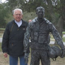
A short anecdote: One of my projects with the county was the coordination of the restoration and siting of one of the Veterans Highway eagle statues that was stored in a Caltrans barn. Working with the Town of Truckee, Caltrans and the Lincoln Highway Association we were able to site the statue in downtown Truckee as a Victory Highway memorial to veterans. We also were able to site various locations of the highway as it went over Donner Pass and down slope paralleling I-80.
Here is a short description of the eagle project by the Truckee Historical Society:
"First installed at the California-Nevada state line on July 24, 1928, the Victory Highway Eagle Monument is now permanently located on the corner of Donner Pass Road and Spring Street in Downtown Truckee in Victory Plaza. This monument is a bronze sculpture designed to honor America’s sons and daughters who served their country in World War I. These statues were intended to be placed at every U.S. county line along the transcontinental Victory Highway but when the Great Depression hit the project was sidelined. Only six of these monuments are known to have been made with Truckee having one of the six. These statues depict an eagle with its 6-foot, 8-inch wings spread protectively over two young eaglets in a nest, symbolizing the United States’ protection of its citizens. The Plaque at the bottom of the statue says “Dedicated to California’s sons and daughters who served their country in the World War 1917-1918 and to the memory of those who gave the last measure of devotion”.
 |
| Victory Highway Eagle Monument below the Veterans Memorial Building in Downtown Truckee |
We are not staying at a destination resort tonight. We are 20 miles into the Nebraska Panhandle at the High Point RV park in Kimball, NE. The town bills itself at the highest point in Nebraska at 5,424 ft. although that is apparently not “settled science” in local academia.
Another long drive tomorrow along I-80 through Nebraska to a KOA near Omaha. We will be there two nights for a pre-visit with our son Brian who will also be joining us in NJ for the family reunion.
Zephyrus - had to Google that one.
ReplyDelete